Unearthing WW2 camp remains
After completing the Mile End Enclosure dig this September, without finding the remains of a Roman site they had hoped for, Worcestershire Archive and Archaeology Service (WAAS) changed direction to make the most of their final archaeological dig activity in October.
Their team shifted a few miles down the road to woodlands in Broadwell near Worcester Walk to survey, excavate and generally investigate the widespread remains of a World War Two camp about which little is documented. The site is in woodland, where Woodville Avenue meets Worcester Walk.
WAAS, our partner leading the Buried Heritage project, have trained volunteers over the five years of Foresters’ Forest funding so they now have excellent archaeological skills. Some of the volunteers are also members of the Dean Archaeology Group (DAG) so they can use these enhanced skills on other DAG activities.
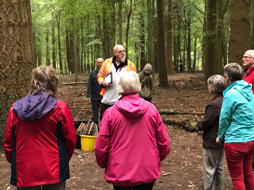
Before the dig, we knew there were various hut bases, paths, and the base of a possible watchtower. The site is well known locally, and on the public Open Day held for the dig, 16th October 2021, we were delighted to greet plenty of residents who turned up to view what the volunteer archaeologists had unearthed and, perhaps more importantly, to share stories they knew about the camp.
 Robin Jackson, leading Archaeologist (centre, photo left), told us that Historic England had previously mapped some of the site using aerial photographs but that this dig was about unearthing structures that have been hidden under tree cover beneath years of vegetation. Very little would have been recorded about the camp for fear of details falling into the wrong hands during the war, and military sites were not allowed to be photographed.
Local historian Terry Halford (who provided photo shown left of similar style of camp hut in Lydney) tells us about the site's history:
“The camp at Milend was planned in late 1940 to house members of No28 ASD who had been sent here to organise and set up an area at first around the Speechouse Area to store the large amount of ordnance expected to arrive in the area. At first the camp was just tents and in 1941 a more permanent camp was planned and lots of buildings were erected. In 1943 the US Army arrived and around 900 worked alongside the British to take in more ordnance. A number of American troops were billeted at Mile End the rest in other local camps. The photograph of the hut was taken at Naas Lane in Lydney. The camp at Milend was never an extension for the Italian POW camp at Coleford; there were some Germans at Milend at the end of the war waiting to be repatriated home. The camp was used after the war by civil engineers who would stay helping with the clearing of the storage depot which had now covered 36sq miles. The camp was vacated in the mid 1950s and demolished shortly after.”
What we learned
This information was gathered mainly from local historians and residents who joined us on the open day:
- Site was probably first used as a base for British Ordnance Corps engineers when they were organising where to hide various bits of ammunition in the Forest in the war
- There was a large Italian POW camp which is documented, Camp 61 at Wynols Hill off Queensway in Coalway.
- Part of the camp at Worcester Walk used for POWs was an ‘overflow’ for Italian POWs but may have been used for German POWs later.
- Bases revealed during the Buried Heritage work are further into the woods, so not associated with the POW camp for the most part (apart from one structure that might have been for guards/searchlight).
- Americans were based here after the British Engineers and possibly adapted and extended the camp.
- Americans were segregated with Black Americans kept separate to White Americans and Foresters couldn’t understand why they would fight amongst themselves. There is a story of a dance organised at Broadwell Community Hall and White American soldiers on the door wouldn’t let black American soldiers in.
- Tales of kids being given sweets and chocolate and residents a Christmas meal by Americans who had lots of food, when British people were still being rationed. Also, of football matches with the Italians and baseball and American football pitches.
The finds
The remains of 30 building structures were unearthed during the dig, many of which had not previously been mapped and all of which pose many questions about their purpose. Through the dig, they have all been recorded to be added to Gloucestershire Historic Environment Record data.
There was evidence that some of the buildings were classic Nissan hut structures built using corrugated iron whilst others were built using a concrete frame and pre-cast concrete slabs. The team are keen to collate information they have learned from local historians and residents who shared local knowledge during the open day to see what they conclude about the camp. Photos taken of the concrete building floors revealed are also being used by WAAS to create 3D images of the buildings, and we hope to be able to share these soon.
Shown below, sample Sketchfab 3D image of dig Structure 24, produced by Tim Cornah (WAAS):
What’s next?
The Buried Heritage team are preparing a more detailed report for us to share and in the New Year (2022) a member of the team will provide a talk for local residents to explain what they found.